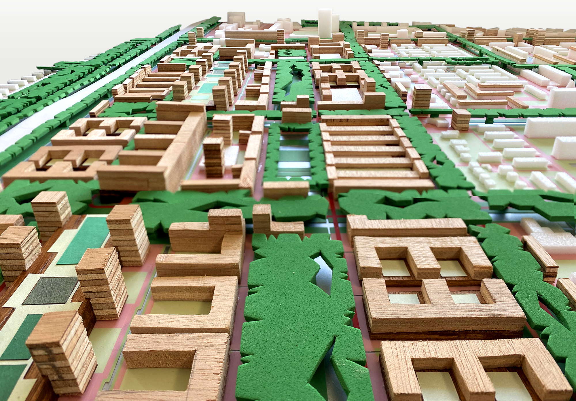

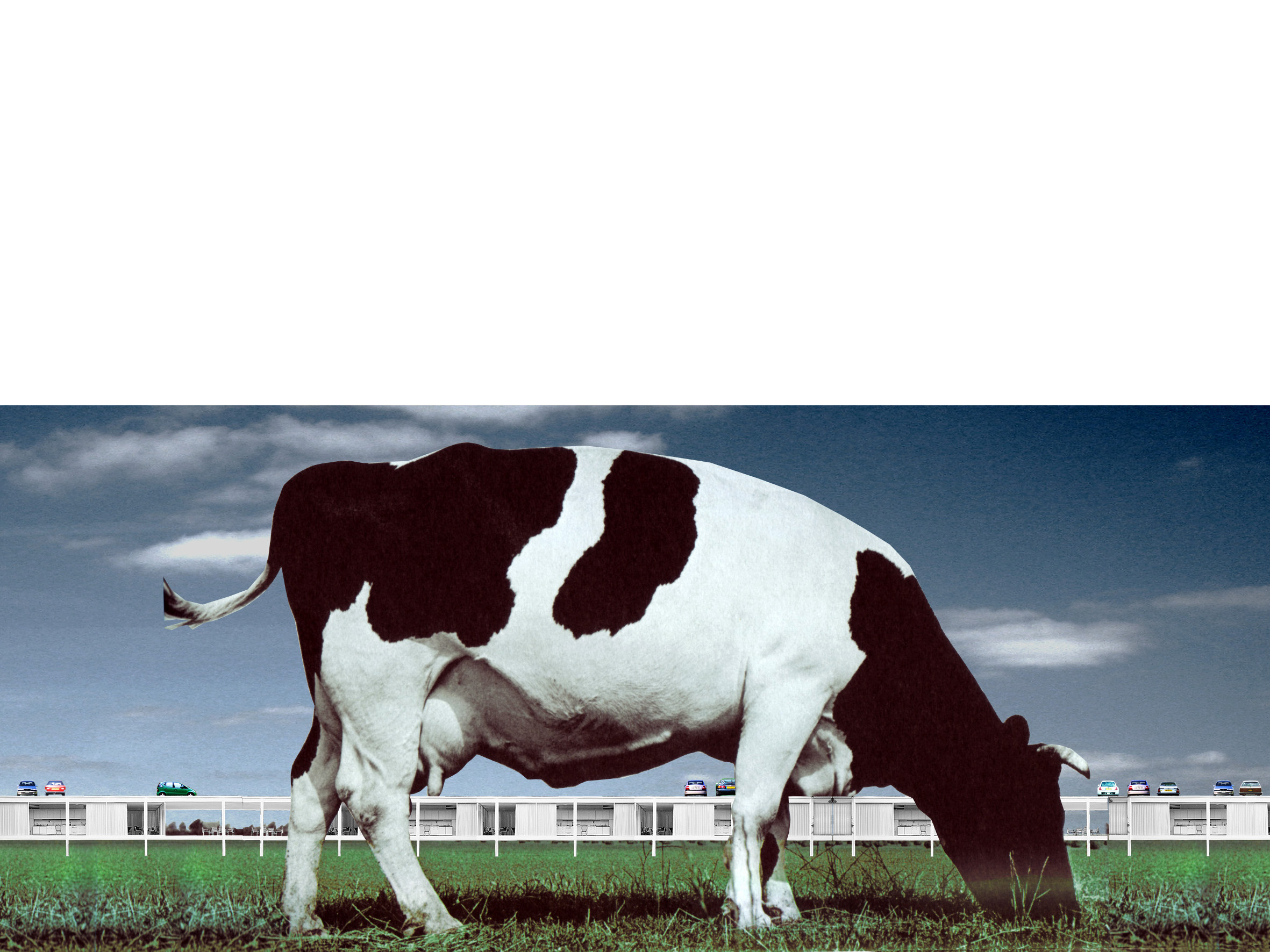
The new existing city
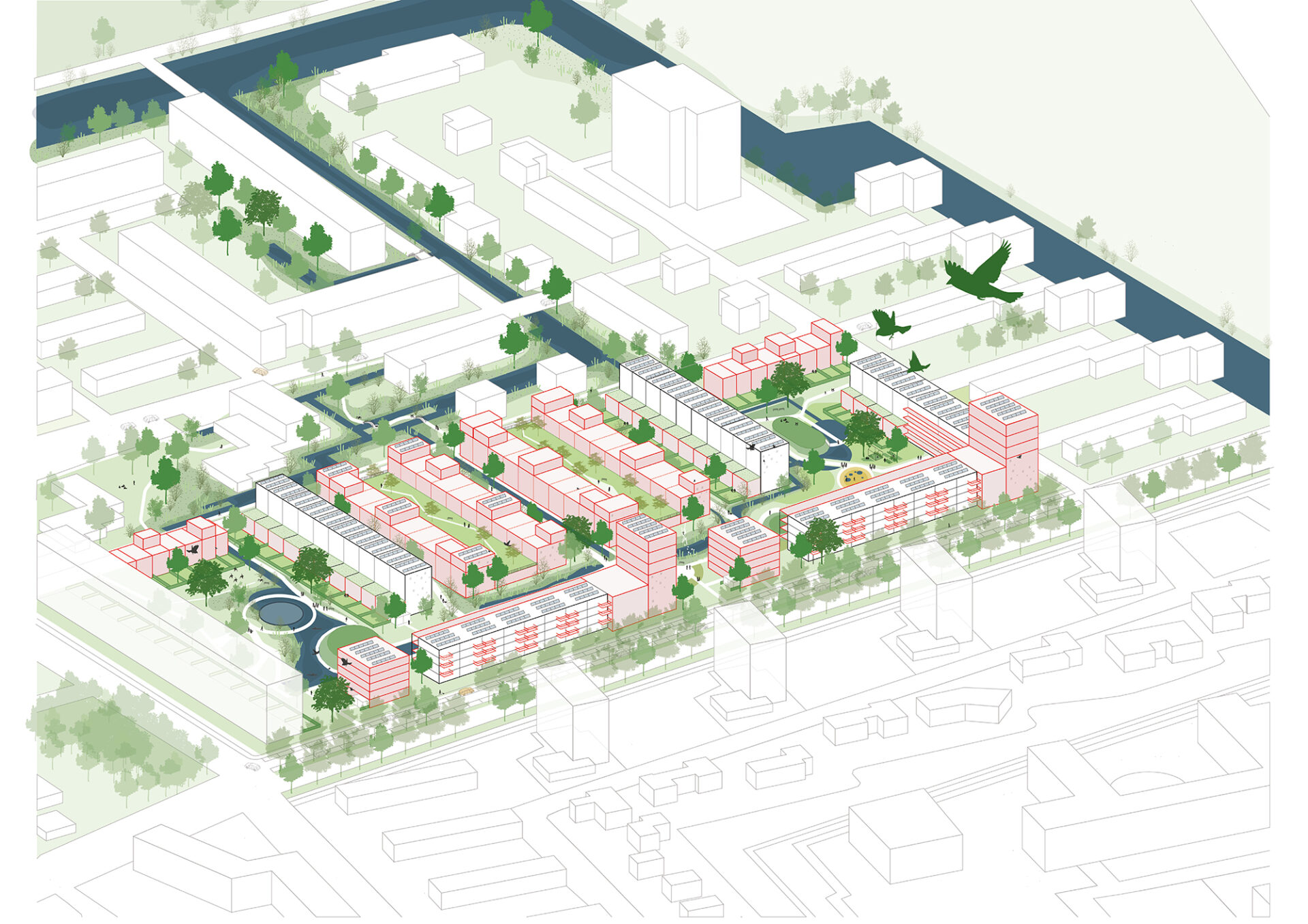
is the title of our entry for the Ministerie van Maak exhibition, following the call to 100 designers to come up with concrete solutions for the housing shortage, the energy transition and the consequences of climate change. Our plan shows how the Rotterdam post-war district Het Lage Land can be densified with 15,000 new homes, new working places and various amenities. The 100 models are showcased during the 2022 Rotterdam Architecture Biennale, in the largest scale model ever made of the Netherlands.
We believe that a significant part of the housing to be built in the coming years must find a place in the existing city. After all, that is where all the facilities, the infrastructure and especially the public transport nodes are located. Inner city densification can also serve as an opportunity to address the water, climate and energy assignments in the existing neighborhoods. And it can provide the necessary new housing typologies for existing residents, elderly for instance, so that they don’t have to leave the neighborhood.


Rotterdam “urbanized landscape”: an agglomeration of introvert islands within the system of the traffic machine
(after a drawing by Frits Palmboom)
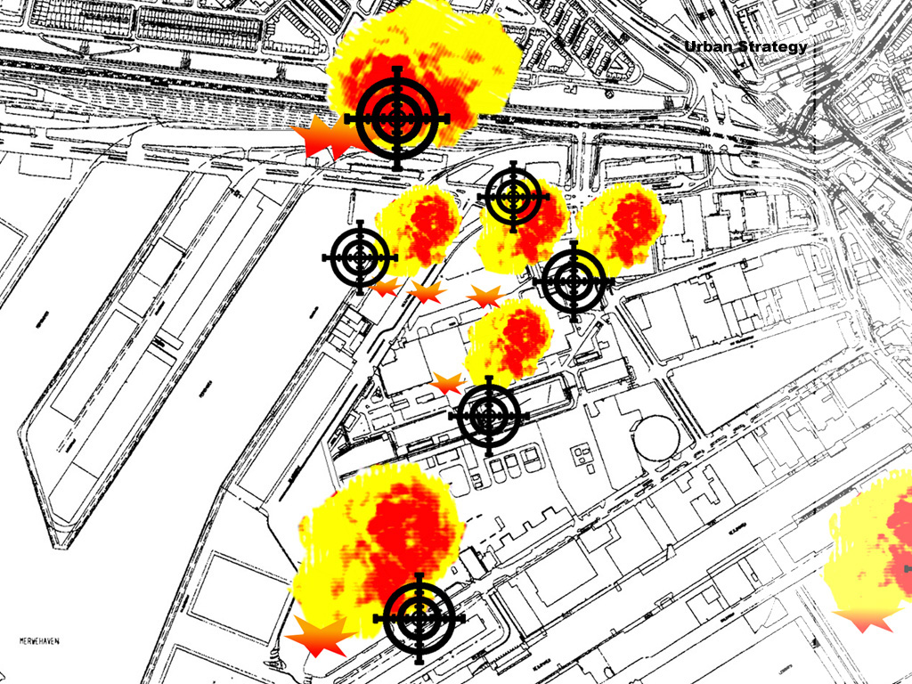
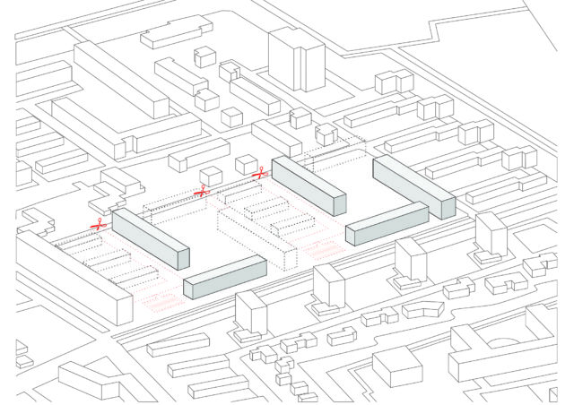
Our location, the post-war modernist district Het Lage Land in Rotterdam, is fertile ground for further densification. Not only with homes, but also with spaces for work, water and greenery. The modernist idiom of separation of functions has resulted here in spacious, introverted residential islands surrounded by oversized transition areas, residual spaces and infrastructure. There is a need for a new urban layer that densifies, differentiates and connects this district with the city around it.


the postwar district Het Lage Land is in need of a new urban layer
The plan makes use of Oswald Mathias Ungers’ concept of Grossformen (megaforms), that unite flexibility and adaptability with permanence and a strong architectural expression. By framing the existing district with a metropolitan fabric consisting of city streets and work-live city blocks, the plan injects urbanity, form and connections in the peripheral residual buffer zones, characteristic of most modernist districts.


We transform the Prins Alexanderlaan, a 100-metre-wide thoroughfare east of the district, into a metropolitan city street. The metro line, located on the ground level, is flanked and topped with facilities and dwellings. The space for the car is limited in favor of cyclists and pedestrians. This gives the adjacent district Lage Land a representative front in the form of sturdy city blocks with dwellings, facilities, shops and offices that focus on the new city street.


We transform the Prins Alexander industrial premises and the adjacent communal- gardens location into a new mixed live-work district. The current low occupancy and low employment rate on this prime location situated right next to the Rotterdam Alexander train station, makes it ideal to partly preserve and partly intensify the existing businesses with new ones and combine them with up to 10,000 new homes. The railway line, located on a dike, will be provided with underpasses and an overpass, dissolving its barrier effect. The parking program of the entire district will be situated above the railway line. The business/industry areas are located under and inside the building blocks. They are accessed from a circular loop, which means that the entire development itself can be car-free.


We transform the neighborhood itself with acupunctural infills and a green-blue network that enhances the biodiversity and the sponge effect of the district. New slow traffic paths connect the neighborhood with its surroundings, including the Kralingse Bos, which we are expanding with a sports forest up to the highway. The Prinsenlaan will be transformed into a linear park connecting the Kralingse Bos with the Schollebos.


acupuncture in the existing district


Large-scale densification, as we advocate it, is complex. Too complex to be left solely to the market. The management should lie with the municipality. The design disciplines also need to sit more firmly at the table. After all, it is the architects par excellence who can think integrally and literally give shape to THE NEW EXISTING CITY.


Westwijk Rooted
Westwijk, an icon neighborhood of post war urbanism, needs renewal. Both the original housing stock and the public space are outdated. The clear urban layout designed by Willem van Tijen offers a good basis to further draw upon. At the same time we will have to break with some of the original principles. We have to move form tabula rasa to tabula scripta and from a separation to combination. More specifically, this means that the relation between the residents (and their houses) and the ground has to radically change and that both the housing stock and the public space has to become more attractive, diverse and sustainable.
Westwijk Rooted is about a neighborhood that is linked to its reconstruction past, its wet soil, the adjacent polder landscape, the new metro station and of course with existing and new residents. A new ground level based on the wet soil condition forms the landscape framework of the plan. It makes the neighborhood climate-proof, water-resilient and biodiverse. At the same time, it creates the ideal conditions for attractive new living environments that are anchored in the ground level.
To help Westwijk and its residents take root, we use the following five strategies:
From floodings … to a climate-adaptive living environment
Westwijk was built in the 1950s on a thick layer of sand without any relation to the peaty ground. By excavating the sand layer in the public space, adding much more surface water to the neighborhood and raising the Krabbeplas area in strategic places, attractive and climate-adaptive residential environments with limited subsidence are created.
From isolated … to connected
In addition to the interweaving of Westwijk with the Krabbeplas recreation area, the connection with the new metro station must also be strengthened. What is needed is an entrance square, a station development with housing and an improvement of the north-south axis that also establishes the link with the Broekpolder.
From skimpy green … to green with value
By better attuning the greenery to the water-rich soil condition, less maintenance will be required and the ecological quality will increase. A greater biodiversity goes hand in hand with a more recreational qualities and attractive walking routes. The green can also be used functionally due to its water purifying capabilities.
From uniform housing … to a diverse mix
Our plan focuses on a varied housing stock with an emphasis on more ground-based housing in the private sector. In Van Tijen’s urban stamps, the necessary adaptions because of the energy transition are used to realize a combination of demolition, new construction, renovation and transformation. In the new development locations on the edges of the neighborhood, a combination is also being sought between homes for young and old, both in the private sector and in social rent sector.
From social isolation … to communities
We are committed to stimulating communities. Communities consisting of residents with a mix of economic strength, age and family situation. Communities that feel connected to their immediate living environment. In addition to the housing supply, the design of the public space plays a decisive role in the creation of these communities.
The deployment of the various strategies provides the ambition map for the Nieuwe Westwijk. This map is not a blueprint, but a dot on the horizon to work towards. Based on two prototypical case studies, we show how this ambition can be put into practice.

Wetering: Core of the neighborhood
In the core of the neighborhood, stamps with one-sidedly oriented residential blocks and an indefinable public space currently dominate the image. By demolishing part of the residential blocks and replacing them with ground-level homes and transforming some of the blocks into homes for families and the elderly, a rich mix of housing types is created. In the public space, a climate-robust, connective and biodiverse outdoor space is created by cutting roads, excavating soil and connecting waters. In the south a more urban wall is being created by the addition of life-course-proof apartment buildings.


Lage Weide: Connection with the landscape
The current situation is characterized by a hard division between landscape and neighborhood. They are separated from each other by a wide watercourse without bridge connections. Our approach is to interweave landscape and neighborhood and to connect both with the natural wet soil condition. This creates a connecting water landscape that forms the basis for new living environments. The current homogeneous housing stock in the stamps is supplemented with new housing typologies with an emphasis on ground-based family homes. To this end, both new constructions (after demolition) and transformation of the existing flats are applied. In order to create more water, ground is excavated. Excavated soil is used to create mounds for a mix of recreation and housing in the landscape.


Ring around Krabbeplas
In order to co-finance the large-scale transformation of the public area of Westwijk in particular, we see an opportunity to make a limited number of specific forms of housing possible in – and especially around – the Krabbeplas area. The condition is that living remains subordinate to recreation and that the residential buildings make a significant financial contribution to the transition of Westwijk. In addition to the residential enclaves located on mounds in the transition area between landscape and neighborhood, we are also providing noise barrier houses along the A20 in the north. Together with water houses on the west bank of the Krabbeplas and a series of CPO residential areas on the southern polder ribbon (Zuidbuurt), a new route around of Krabbeplas is created.


Beach City 2.0
In 2012 Shift architecture urbanism made a spatial vision for Beach City on behalf of the municipality of The Hague. Building on the study of Shift architecture urbanism, the Beach City Foundation has asked Shift to contribute to a supported programmatic vision for the total concept. All the different stakeholders (water sports, beach sports, boardwalk sports, catering pavilions and the stadium) were represented in drawing up this vision. Based on this programmatic vision, Shift has made a design proposal for the location in collaboration with LOLA landscape and POSAD spatial strategies. This design takes the extension of the Scheveningen boulevard as a starting point and concentrates a large number of different sports in a sports dune, a sports square, a sports boulevard and a sports quay.
The Beach Sports Accommodation (BSA) is central to the design. The BSA is the programmatic heart of the area and facilitates the various sports landscapes. In addition, it also facilitates the beach stadium that descends on the beach in the summer months.
The beach sports accommodation is a flexible building that enables a wide range of user scenarios, a contextual building that responds to the unique location on the beach, boulevard and sea and a connecting building that makes the link between the higher situated square and the beach and the various (sports) activities.
The building consists of two main functions: a permanent Beach Sport Accomodation (BSA) and a temporary Beach Stadium. The BSA functions as the center of Beach City all year round. Here are facilities for the wide variety of athletes who visit Beach City as well as other visitors. In addition to a sports canteen, the BSA houses multifunctional spaces that enable the building to accommodate a wide range of usage and exploitation scenarios. There are changing, shower and locker facilities specifically for athletes.
The Beach Stadium will be added to the BSA in the summer season, or will only be built at the time of major events that require such a stadium. It consists of temporary stands around a Center Court and is enclosed by a lockable boundary. This makes the stadium suitable for sporting events and other types of events that can be both freely accessible and “ticketable”.


The BSA is located at the head of the square, at the end of the new boulevard. This prominent position gives the building a landmark function for Beach City. A landmark that makes Beach City clearly visible and accessible from the Scheveningen boulevard, the beach and the sea. The positioning of the Beach Stadium on the sea side of the square guarantees the visibility of the BSA.
The BSA is an all-sided building consisting of four quadrants, separated by 2 axes that form a central hall in the middle. Each quadrant has its own function and shape that is derived from its specific orientation.
The quadrant, oriented towards the sea and the beach, contains the canteen whose round glass façade underlines the panoramic view. The quadrant aimed at the Beach Stadium is designed as a round bite out of the building that connects to the contour of the temporary stadium, which contains a multifunctional space that can be used as part of the canteen as well as separately as a skybox towards the stadium. The quadrant towards the boulevard and square contains a cluster of multifunctional spaces designed like a glass house. The quadrant towards the windward-facing part of the beach, where the permanent beach sports fields are set up during the bathing season, is designed as a grandstand with all the changing, shower and locker areas for the athletes underneath. These facilities are directly accessible from the beach via an entrance in the grandstand.

The two transparent axes through the building make the building publicly accessible from both the sports beach and the square. From the main entrance on the square one looks and walks straight through the building towards the open beach. The axis transverse to this also provides access to the building from the private part of the sports beach.

The grandstand makes the roof of the building accessible. This creates a public viewpoint from which one has a panoramic view of Beach City. By also making the roof accessible from the building, it is possible to design the roof as a terrace and multifunctional space during (sports) events.

Zwanebloem Inside Out
A child has three teachers: the first are the other children, the second is the schoolteacher and the third is the spatial environment. (Swedish saying)

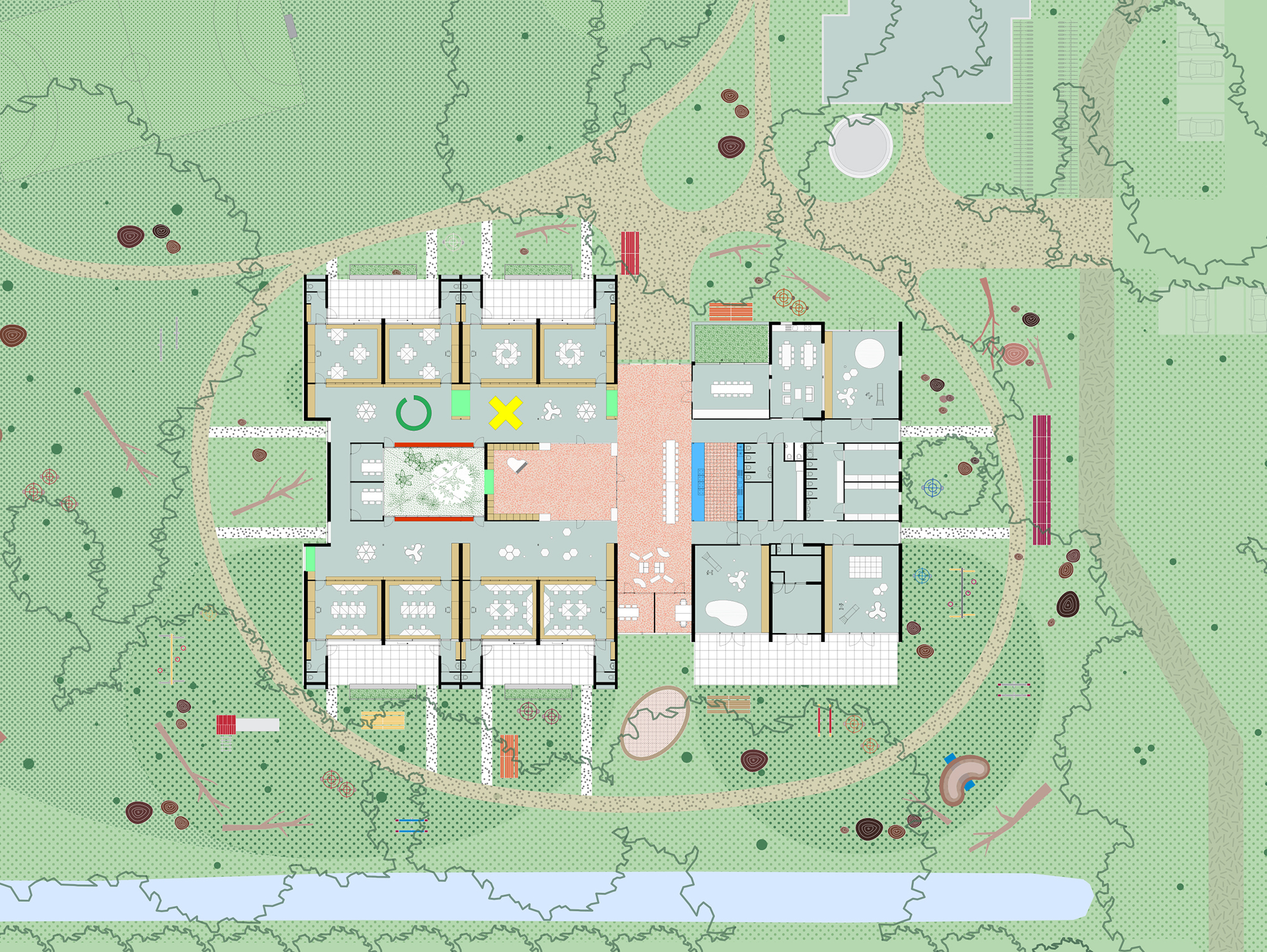
Zwanebloem INSIDE OUT is a proposal to transform the existing 1970ies elementary school into an “Integrated Child Center”, consisting of an elementary school, nursery, daycare and community center, embedded into a unique green outdoor domain. The combination of these functions into one complex makes it possible to provide a consistent environment for the development of the child, guided by a single pedagogical vision. Zwanebloem’s vision promotes the idea of the school as foremost the place for meeting and interacting with the others, besides being a learning environment. The child becomes part of a larger whole, learning how to live together with the other children and teachers, in a community where everyone feels safe, secure and valued. The educational vision is based on a play-learning process in which the child is encouraged to shape his/her own playing and learning environment indoors as well as outdoors, in the school’s extensive and exceptional green domain. Besides the usual activities like sports, play and gardening, it is the school’s ambition to regularly organize here outdoor classes, reinvigorating the open-air school Dutch tradition.

The original building is a standardized design of the “corridor school” type with two rows of class rooms arranged on the two sides of a wider corridor area, where several communal functions are organized. A central patio that used to bring light in the central area had to make way in recent years to an enclosed playroom. Subsequent adaptations of the layout to incorporate new functions have compromised the original clear spatial design. Despite large windows in the classrooms, the physical connection between classroom and the outdoors is missing.


In order to meet the ambitions for outdoor education and the new pedagogical vision, we have literally turned the school inside out. Each classroom is provided with its own little entrance building situated in front of the existing façade and containing the garderobe and a toilet. Like this, each class has its own address at the outside domain, situated on a path that encircles the school. Each year the children move to the next class, completing during their educational cycle at Zwanebloem the complete circle. Two opposite entrance buildings define the space for an outdoor classroom, which can be used by two adjoining classes. In the other direction, this outdoor classroom is equipped with two long benches: one formed by the oversized windowsill in the original façade and the other by a large new planter containing the educational garden for each class.


Inside the school building, the original construction with columns allows for variations in the layout of the classrooms. Instead of the classic setup with large classrooms along a corridor, a new layout is proposed with “core classrooms” and “learning plazas”. Each classroom is compressed into a more compact space where the teachers can instruct the children, while the rest of the space forms together with the corridor a “learning plaza”, an open collective space shared by all the classes, where the children are encouraged to find their own place for self-study or work in groups. The resulting plan is a layered composition of parallel bands, offering a variety of spaces and learning conditions from private, quiet and intimate, to open, lively and collective.


various scenarios for how the different spaces are used: morning, afternoon, good weather, after school and event
At the core of the building, the wide corridor is extended to form a cross-like figure combining all the collective functions. The vertical arm of the cross separates and at the same time connects the school on the western side and the nursery/daycare on the eastern side. Here the new central entrance is situated as well as the coffee corner, refectory, library and meeting rooms. The horizontal arm of the cross accommodates the central kitchen, meeting rooms, a new patio that brings light and green back into the heart of the building and the playroom. The removable walls of the playroom convey the possibility to create a central plaza for school events or neighborhood gatherings at the heart of the cross.

Besides on spatial aspects, the transformation also focuses on climatological aspects, providing new insulation of the outer skin and a new ventilation system. The ventilation system is realized centrally for the daycare/nursery and decentral for the classrooms and “learning plazas”. The decentral ventilation units are placed on top of the toilet/garderobe in each of the new entrance buildings, integrating the ventilation grills as decoration in the facades.


successive cross sections
The research was commissioned by Mevrouw Meijer, an idealistic research platform that aims to improve the architecture of schools through initiating research by design trajectories. The foundation is committed to the revaluation of existing real estate, acknowledging the societal meaning of the school building and the more prominent role of architecture in this.


Hyperlocal Micromarkets in shutdown realities
In this self initiated research-by-design project, Shift architecture urbanism argues for micro markets that operate on a hyper local scale during corona shutdowns. They keep the food market traders and the whole supply chain behind them in business in order to provide fresh food in a safe way to the self-quarantined inhabitants of the city. Their hyper local character limits the amount of travelling through the city and their products on offer release the pressure on the supermarkets that have a hard time reducing the contamination risk.
At this moment in time, there is a strong worldwide consensus that shutdowns are our only answer to stop the corona virus from infecting us too fast to cope with. The actual form that this shutdown should have and especially its severity, has brought many dilemmas to governmental bodies that impose them. One such dilemma is how to guarantee the distribution of fresh food and groceries with a minimum of risk.
In the attempt to limit physical contact between people, the purchase of food is probably the weakest link. In the various shutdowns over the world, supermarkets have not been closed since they are part of our vital infrastructure of food distribution. Online shopping, by far the safest way to get groceries, is booming but cannot replace physical supermarkets in terms of capacity and reach. Nor can the various drive-through food solutions that pop up in many places.
While most supermarkets have stayed open all over the western world, the various lockdowns have been less consistent regarding the fresh produce markets. There are big differences between countries and regions. In the Netherlands for instance the large weekly or semi-weekly street markets have stayed open in many cities, even in the province of Brabant, the Dutch corona epicenter. In some cities they have been reduced to food only. In others, such as Rotterdam, they have been closed altogether.


from large centralized markets to small dispersed micromarkets
Even with protective measures it seems very difficult if not impossible to rule out the risk of contamination in traditional fresh produce markets. The social distancing rules are very hard to control and many people are touching the same products. But this is also the case at the supermarkets that do stay open. Furthermore, closing down the markets will put even more pressure on the supermarkets and will further disadvantage people with lower incomes. Many households depend on the open-air market for their basic food needs. Closing the markets forces them to switch to the more expensive supermarkets, putting further financial pressure on these more vulnerable groups.
So, what to do with the fresh produce markets in the context of the shutdown? When referring to another corona problem, the one of creating new hospital facilities in an extremely short time, Lt. Gen Todd T. Semonite, commander of the US Army Corps of Engineers, said:“This is an unbelievably complicated problem,” he added, “and there is no way we are going to be able to do it with a complicated solution. We need something super simple. So, our concept here is a standard design.”

Shift’s proposal is to keep the vital function of the fresh produce markets fully intact, even strengthening it, while at the same time minimizing its potential role in spreading the virus. For this, the large markets have to continue in a different form, place and time. Its former model of concentration has to be replaced by a model of dispersion, both in space and time. This is done by breaking down the large markets into so called micro markets that are spread over the city and opening them up for a longer time. Instead of you going to the market, the market is coming to your neighborhood. These hyper-local markets are open at least 5 days a week instead of twice a week to further reduce the concentration of people.
The micro market’s standard spatial setup consists of a 16 square grid, aligned with three market stalls, each selling a different kind of fresh produce such as fruits, vegetables, dairy products or meat. The grid is taped on the pavement and fenced off with standard crush barriers. It has one entrance and 2 exits. In order to maintain social distancing each cell can only hold one person. In order to permit movement, the grid can only hold a maximum of 6 people. These rules are made clear at the entrance of the micro market, that has a waiting line taped on the pavement. The stalls will offer packages instead of separate products, to limit the time customers spend in the grid.

How to do all this fast, simple and in an organized way? To split up and disperse the market is fairly easy to do in a short period of time. Unlike the supermarket, the street market is composed of very flexible and mobile units. Most market traders are used to relocate their stalls every day. Also, the realization of the micro market is easy and fast. It only needs standard products for traffic and crowd control that each municipality has in stock. Finally, the assignment of the different stalls over specific places of the city should be coordinated by the municipalities in cooperation with the market managers of the existing markets.

XS Deluxe


Superhub
Waalhaven Zuid, a derelict harbor area in the South of Rotterdam, has an outstanding location in the network of freight transport. It has connections to road (A15 highway), water (both short and deep sea) and rail infrastructure (Betuwelijn).
This project proposes to transform Waalhaven Zuid into a logistics superhub that combines a very high distribution capacity with an excellent connection to all these modes of transport.


Gradual transformation
The project takes the existing layout and road infrastructure of Waalhaven Zuid as a given. Within this framework the area will be gradually transformed into a hyper efficient logistic superhub. In order to do so, the buildings are scaled up drastically in all three dimensions.

The core business of Superhub is Value Added Logistics. Instead of just storing and trans-loading cargo, the cargo will be subject to a simple production operation such are repacking, labeling or assemblage . In this way value is added, money is earned and jobs are created.

By connecting the area directly with rail and water, Superhub triggers the use of these modes of transport as an alternative to road transport. This so called “modal shift” is necessary to reduce the dependence of the Dutch (and European) logistic sector on truck transport.

In Superhub, business clusters (fashion, food, electronics, etc.) will be created to achieve synergy advantages, share services and improve the corporate appeal of the area.

The final masterplan consists of an array of purely functional buildings around a linear plaza that forms the social heart of the area. Here one finds large truck parking’s and services for the users of the Superhub: truckers and employees.


A new container terminal links Superhub’s distribution capacity directly to both short- and deep sea.

By introducing multi-storey warehouses, the distribution capacity of the site will literally be multiplied. A central system of ramps makes it possible for trucks to navigate the buildings vertically. The so called 3D-Distri buildings are framed by functions that relate to the distribution function of the complex and the specific product group it deals with. One can think of offices, shops, consulting services, outlet centers and showrooms.

Superhub Waalhaven provides a model for concentrated logistic main ports, being an alternative for the sprawl of logistic business parks all over Holland that fully depend on car and truck mobility.


Concentrating logistic mainports
The project also pleads for bringing back true harbor activity in the immediate vicinity of Rotterdam. A city struggling with an unrealistic vision of “city harbors” that envisages fantastic housing ambitions along the river it cannot make true. Rotterdam is a working city.


Studio Sport
With Studio Sport, Shift architecture urbanism shows how, where and why sport should be mobilized to boost urban quality. The result is a plea for hybrid urban sport places that are spatially and programmatically integrated in the existing city. They release sport from its isolated position, introvert character and mono-functional programming and charge the urban landscape with meaningful new places of (inter)action.


traditional city vs. sports city
Sport is sexy and it’s everywhere. It is connected with fashion, music, lifestyle, media, the street and the city. If sport was once the exclusive domain of clubs and associations, these days it is an indispensable part of our society and daily life.

In recent years, sport has developed from a goal in itself into an instrument. An instrument for policymakers to reach social targets, an instrument for commercial sport organizations to earn money and an instrument for municipalities to develop city marketing. Every Dutch city wants to be a sports city, or even thé sport city.

Sports and sportspeople are moving ahead too. The number of sports is growing fast, as is the so-called non-organized, spontaneous practice of sport, which takes place outside the context of the club, within the public domain of the city. This trend is expected to continue, as it corresponds to the need for flexibility of the modern urbanite.

Sport’s value for the community and the economy is getting major coverage in politics, the civil service and the media. Sport is good: good for your health, good for social cohesion, good for your image. Strikingly enough, the so called instrumentalization of sports has been overlooked by the spatial disciplines. Sport is subject of rest planning and its value for the city and its public domain is unexploited.

In the modernist city planning sports parks were allotted a place in the green zones sometimes in but more often around the city. The sports park was a way of escaping the hectic city.


In later urban urban expansion schemes many sports facilities had to make way for new residential and work areas. As a result sports parks shifted ever further outwards to end up in isolated leftover areas and ragged edges of the city, often right up against motorways or railways.

This back-seat status held by sport in spatial planning has led to the ‘islandisation’ of sports that is completely at odds with the development of sports itself and the social and economical roles it got assigned by the outside world.

High time then, that sport’s key place in society is reflected in the way it is designed and integrated in the city. The question is what sport can mean for the city and, conversely, what the city can mean for sport. Sport can benefit the city and its public domain. It provides a counterbalance to the impoverishment of public space by charging it with activity and dynamic. Sport is one of the most powerful means to get people out of their protective home environment during their leisure time. It provides frameworks for encounter and interaction, two prerequisites for a vibrant public domain. In addition, qualitative sport facilities enhance a city’s attractiveness as a place for companies and residents to settle.

Also the city has to offer quite something to sport. First of all, large groups of city dwellers would like to sport close to where they live, especially in the “problematic urban neighborhoods”, where car mobility is limited and there is a large demand for sports. Secondly, the city provides the possibility to connect sports accommodations, that generally have a low intensity of use, to other urban functions in the field of education, culture and neighborhood facilities. Smart programmatic synergies lead to a substantial intensification of sports use in space ánd time.


In a series of concrete case studies in Rotterdam, The Hague and Amsterdam, developed in collaboration with the municipal departments of spatial planning and sports, Shift has explored the Dutch city for its potential to integrate sport on a structural level. The issue on the one hand is to stitch existing, often isolated sport locations to the city and on the other to integrate new sports facilities in the city.

The case study projects have resulted a new kind of urban typology: the hybrid urban sports place. In these places, several sports are combined with each other and with other urban functions. Their hybrid character is reflected in the balance that they seek between formal and informal, top-down and bottom up, commercial and public, inside and outside, sports and other programs.


They are designed as urban landscapes with an open and flexible character, rather than closed utilitarian facilities. They function on the level of the neighbourhood, the city or the region, depending on their size, program and position in the city. Despite their speculative character, the proposals have a high level of realism and they react to concrete urgencies. Three case-study designs have led to further spatial and financial feasibility studies, commissioned by the municipalities or other stakeholders.


In addition to the case study projects, the website sportspace.eu was developped. SPORTSPACE is an online platform about urban sports spaces. The website collects reference projects of sports and movement spaces that are successfully embedded within the city and connects these with spatial design tools. It functions as a source of inspiration and a frame of reference for everybody who’s interested in the potential of sports for the city and vice versa.

The full body of work of Studio Sport was exhibited in the New Institute (former Nai) in Rotterdam. The exhibition was openend during a conference in which specialists from the domain of sports and space were triggered to participate in a constructive dialogue.


Binnenrotte SportSquare
Twice a week, the Binnenrotte accommodates a large market. The rest of the week, it forms a huge strip of emptiness at the heart of the city centre. On these days, Rotterdam’s largest square hopelessly craves for activity.
This project capitalizes on the Binnenrotte’s unused potential. It transforms the square, on days when there is no market, into thé metropolitan sports place for all Rotterdammers: a place for jogging and skating, football, tennis and hockey; a place for sports clinics, tournaments and gym classes of the surrounding schools; a place for informal activities, play and cultural manifestations.


marketsquare vs sportsquare

In order to guarantee the multiple use of the square, a specific sport toolbox has been developed. Its tools enable the continuous metamorphoses from a market square into a multifunctional sports square and vice versa, all week long, year-round.


Toolbox to transform the Binnenrotte from a market into a sport square and vice versa
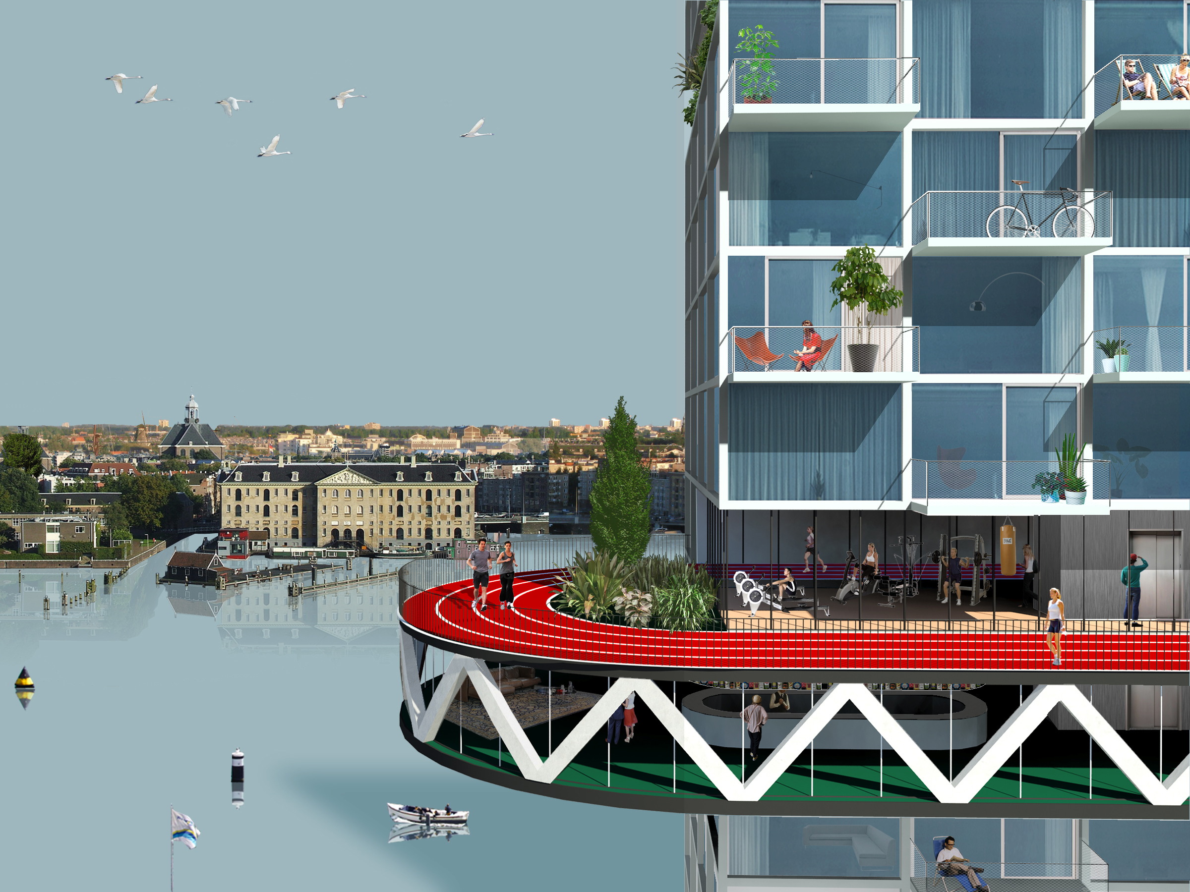
An 800-metre urban athletics track encircles the square. It functions as a shared space for pedestrians, joggers, bikers and skaters.

Two multi-sport fields out of concrete are enclosed by a pergola structure with motorized curtains that automatically descend on sport days and retract on market days.


“curtain” fields
Two moving platforms – continuing a Rotterdam tradition that includes the nearby vertical-lift railway bridge De Hef – accommodate sports activities that require a surface other than concrete.

One consists of an artificial grass platform with variable positions: set at ground level on sports days; lifted to form a covered market space on market days. The other structure features a covered artificial ice rink, with a roof that descends to ground level to become a wooden deck on market days. Finally, a sun-oriented stand accommodates a clubhouse underneath, with space for locker rooms, showers and the offices of both the square’s sports and market manager.


moving artificial grass field
The Binnenrotte Sports Square lives up to ‘Rotterdam’s Sports City’ ambition and injects the city centre with the much-needed activities other than consumption.


OPEN specifiCITY
The open city stands or falls on the way it manages the organisation of diversity. Our heterogeneous society demands a planning regime that shapes the exchange between and the overlap of different worlds. The public domain, in particular that of the square, is typically the place where contact between different sections of the population is stimulated and forms of new collectivity take shape.
In order to redevelop the square into a social space that ties in with the reality of the open society and that of the network city, we must introduce new types of buildings and squares. These types must be at once open and specific: open to different groups of users and uses while at the same time specific enough to produce the necessary differentiation and identification.

The Western Garden Cities, are being transformed with little regard for the original qualities of the modern city. The open structure of the initial General Extension Plan is replaced by a defensive form of urban planning that sources its ingredients from the pre-war city. Parks are fenced off, flats are replaced by perimeter blocks and open squares are redeveloped into indoor shopping areas.
The result – a patchwork of gentrified enclaves – may be filling the indeterminate open space of the original city, but is incapable of accommodating new forms of collectivity.

The brief for the August Allebé Square offers the opportunity to formulate an alternative strategy for the ‘problematic legacy’ of the modern city that failed to respond to demographic developments. This must be a strategy that sees the open city and its diverse population not as a problem, but as a chance to forge new types of collectivity and urbanism.


The design proposes a new spatial and programmatic composition that opens up radically on the levels of both neighbourhood and network city.
The potential of the square’s strategic position between the regional axes (A10, metro and train) and the major thoroughfare (Postjesweg) is capitalized on by spanning the square in between these different axes and introducing programs that are relevant on both regional and local levels.

In order to program and differentiate the larger space of the square, while at the same time safeguarding its openness, a new type is introduced: the so-called ‘pleingebouw’ (square building). An amalgam of building and public space, the square building is capable of adding programmed mass as well as charged emptiness to the square as a whole.
In dialogue with the existing buildings and/or embedded within the infrastructural network, a sequence of square buildings will enrich the open space with a number of urban archetypes (the podium, the colonnade, the canopy, the plan oblique and the frame).


snake


collonade


podium


table


labda


oblique plan
The result is a square-within-a-square-situation, which can simultaneously accommodate different groups and activities without disrupting the continuity of the open space.
The explicit programming of the masses (public transport, commerce, culture, community and sport) and their specific design imply the use of adjacent public space without fixing it. There will still be room for improvisation, spontaneity and the appropriation of the squares by different groups.


The August Allebé Square in its entirety is more than the sum of its individual parts: the co-existence of different groups and their activities transforms the square into an urban “coulisse landscape” where one is constantly reminded of the presence of parallel worlds, of ‘the other’.


M3


Indoor Farming
Indoor Farming is the future of urban farming. It allows for vertical farms that grow all crops, in any place, at any time. This project researches and illustrates why, where and how high tech indoor farms should be integrated with the urban landscape. They render the old, centralized way of doing horticulture obsolete and promise a high capacity local food production that biological farming is unable to deliver.

The current organization of the world’s food production and distribution is under pressure. New economies and increasing urbanization ask for more, better, safer and more secure production capacity, while growing land and water shortages, climatologic problems and plagues lead to an increase of food crisis. Today’s centralized food production, with crops being grown where the climate conditions and land values are favorable and/or knowhow is available, is no longer sustainable. It results in long and complicated supply chains, poor food quality and enormous food losses of up to fifty percent.

In the last decade, new urban farming initiatives that promote biological and local food for the city seem to pop up everywhere. However their market share is still very small. It is very much the question if these sympathetic initiatives, as long as they are based on (semi-)traditional farming technology, are capable of generating a structural change in our global food system. They are relatively inefficient, require literally lots of space, produce a rather limited variety of products and rely on unreliable climate factors and sources.
With the new technology of indoor farming, developed by Plantlab and other pioneers, new opportunities for efficient local food produce for the city arise. Instead of relying on existing climate conditions like traditional agriculture and greenhouse farming, Plantlab introduces a very compact crops production method with 100% control over the growing process, independent of climate, place and time.

The method of Plantlab is based on indoor crops cultivation in climate rooms, so called ‘Plant Production Units (PPU’s). These PPU’s are equipped with fully automated installations, including LED lighting systems, creating the ideal growing circumstances for the specific crops inside. This method makes it possible to grow practically all types of fruits and vegetables on any location. Not only does it increase the quality of the food, it also consumes far less space and water than any other form of crop farming. Because it is no longer depending on natural sunlight it is possible to stack the different production units, and create vertical farms. At the moment, Plantlab’s system is commercially viable for specific high quality crop products such as spices and medicine. The prognosis is that in the near future, when the LED technology is improving in terms of energy use and price, many more applications are ready for the market.


How should the new indoor farming technology land in our urban environment? Indoor farming can manifest itself in and around the city on four scale levels: S, M, L and XL. Each level is characterized by a specific application of the indoor farming technology and relates in different ways to its context.


S and M farms function on the level of the building. Restaurants, hospitals, offices and even households can start their own production unit for private or local use. Also supermarkets are able to produce part of their vegetables in the house. These small scale initiatives play an import role in generating awareness and social acceptance of high tech indoor farming.
In order to achieve a real paradigm shift in global food production, indoor farming has to be realized on L and XL scale levels. On this scale, the system can benefit from existing automation technologies that are currently used in greenhouses. This allows for an unprecedented production variety, capacity and efficiency in the urban environment. The autarchic city in terms of crops production will eventually combine all scale levels: from the micro scale of the household to the macro scale of the indoor green port.


Large and extra large indoor farms can be realized in the urban landscape in a variety of ways. Their modular and stackable character allows for site specific farms that are integrated in the context. The denser the context, the higher the indoor farm will become. In the compact city, the indoor farm will take a vertical layout with dozens of cultivation layers on top of each other. Their compact footprint will accommodate food retail units that form the interface with the city and its consumers.

The possibility to stack indoor crops production allows for vertical farming towers right in the middle of our cities, the place where a lot of end consumers live and work, but space is scarce. Despite of their small footprint, these vertical farms can generate large, varied and year-round volumes of fresh fruits, vegetables and spices.
In the periphery of the city, the indoor farm will acquire a mono-functional and industrial character. Outside of the city, large scale indoor farming green ports will arise that provide food on a regional scale. These large complexes can manifest themselves as integrated landscape elements, connected to the existing infrastructure. In all cases, indoor farming has to be combined with sustainable energy farming and/or the use of urban waste energy.
The rational layout of the Dutch polder lends itself for large scale indoor farms designed as geometric elements integrated in the mondrianesque landscape. They charge the polder with new agricultural production value and enable the surrounding old fashioned farmland to grow bulk crops, have milk cows or transform into recreation areas and energy farms that supply sustainable wind energy to the indoor farm. The new XXL polder farms will become green ports that produce high quality crops for the region.

Large scale indoor farming on the level of the region can be integrated in noise barriers along the highway. These new highway farms are directly connected to the Dutch highway infrastructure from where the regional distribution will take place. Highway farm A4 becomes a linear green port that provides food for Randstad West. Its internal logistics, in particular the vertical circulation of the crops, shows itself clearly to the car traveler by means of a glass façade that separates the crops elevator/lift machinery from the outside.

The current food wholesale in Spaanse Polder, Rotterdam, functions as an important food hub for business to business distribution. It is being supplied, via Roterdam harbor, by crops that have travelled from all over the globe. Indoor Wholesale Farm positions the production of practically all crops, right there where the food is being distributed. It reduces the food miles to the regional scale only.

Densely populated desert cities can locally produce their own food supplies with large scale indoor farms, powered by solar farms.


Exorcizing on Communist Hardware

Bulb City